eLiteMap features
Powerful map application for offline work
Access your interactive maps everywhere you go with your mobile device. Create and search features, use navigation and other tools offline.


Work in the app without authorization, payments and in-app purchases
To access mobile maps, paid subscription as well as corporate and any other accounts are not required.
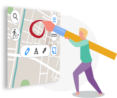
Add features on your map
You can create new features on your mobile map by simply adding points, lines, and polygons directly with your mobile device.


Add attachments to features
Make the features on your map more informative by adding photo, video and other attachments. To do so, just take a photo/ video with your device camera or download the existing file from your device gallery.
Add graphic marks to your mobile map
Adding arrows or drawing free hand graphic on the mobile map, you can mark the places you need to remember or which you want to show your colleges upon returning to the office or mark the features that need to be defined more accurately and complemented later.

Share your data and experience
eLiteMap supports import and export of data in the most common formats, so you can easily exchange your data with other users in the needed format.
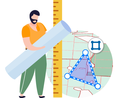
Take measurements on the map
The app provides measurement tools to quickly calculate the distance between objects, the area of the polygon, and the radius of a circle with the center at the selected point. You can determine the geographical azimuth on the map and use a circular ruler to identify equidistant objects.
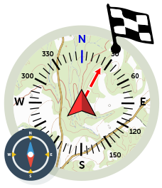
Use map features as destination point
Select the feature to be used as the destination of your route, and the app will help you estimate the distance to it, as well as indicate the needed direction in compass mode.
Record your GPS tracks and create polygons based on them
Using the GPS positioning system of your mobile device you can record your GPS tracks and display your current route on the mobile map. With this option, you can walk/drive around the needed territory defining its boundary and area.