New eLiteMap version for mobile devices

New version of eLiteMap app for mobile devices is released. Download the updated eLiteMap from mobile app stores or on our website to evaluate its new features and improvements.
We are happy to announce that the new version of eLiteMap mobile app is available for download. In this version, we have added a few new tools, implemented additional capabilities for creating lines and polygons, enhanced the app interface usability, as well as improved overall stability and performance.
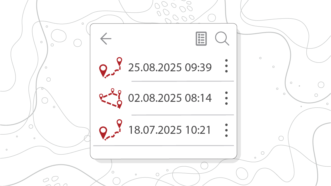
Tracks log
Now all your tracks are automatically saved to the tracks log when recording. Tracks are sorted by date and time. You can find and restore any track even if an error occurred and the application was interrupted.
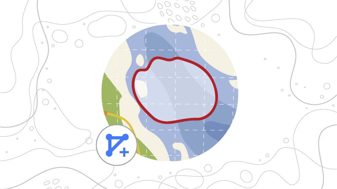
Creating objects by drawing freehand line
The complex contours of the polyline and polygon objects on the map can now be created with the freehand lines. In the application settings, you can always select the needed method for drawing objects, either using straight or freehand lines.
Adding maps and data from device’s storage
Add the necessary maps, projects or data stored in the memory of your device by pressing the button with the folder icon in “MY MAPS” and "MY DATA" tabs. The added files are automatically copied to the application folder.

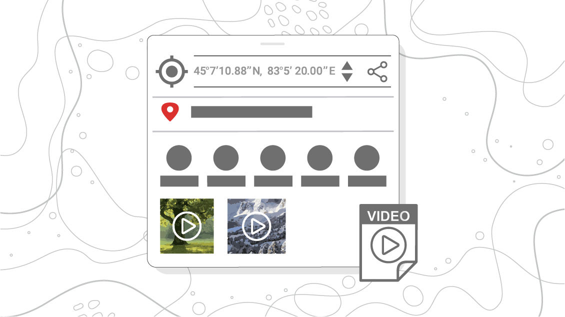
Added preview for video attachments
Evaluate the changes in the display of video files in the new mobile app version. Now videos attached to the objects are displayed in the identification card as preview images. Make your map more illustrative by adding videos, photos, audio files and documents to the points and tracks on the map.
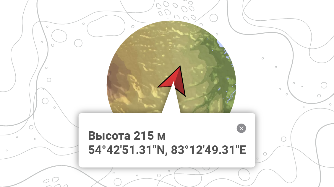
Accurate calculation of height values using geoid model
For devices running Android 14 and above, the height values at the current location are now calculated taking into account the Earth’s surface. *
Using a global geodetic model of the Earth’s surface (geoid) increases the accuracy of measurement and reduces errors associated with the relief of the Earth’s surface when determining the height at the current location and setting Z-coordinates (height) when creating objects and recording tracks.
*Please note that for devices with Android version 13 and below, the height values are still calculated based on GPS/GLONASS receiver data of your device without additional adjustments.
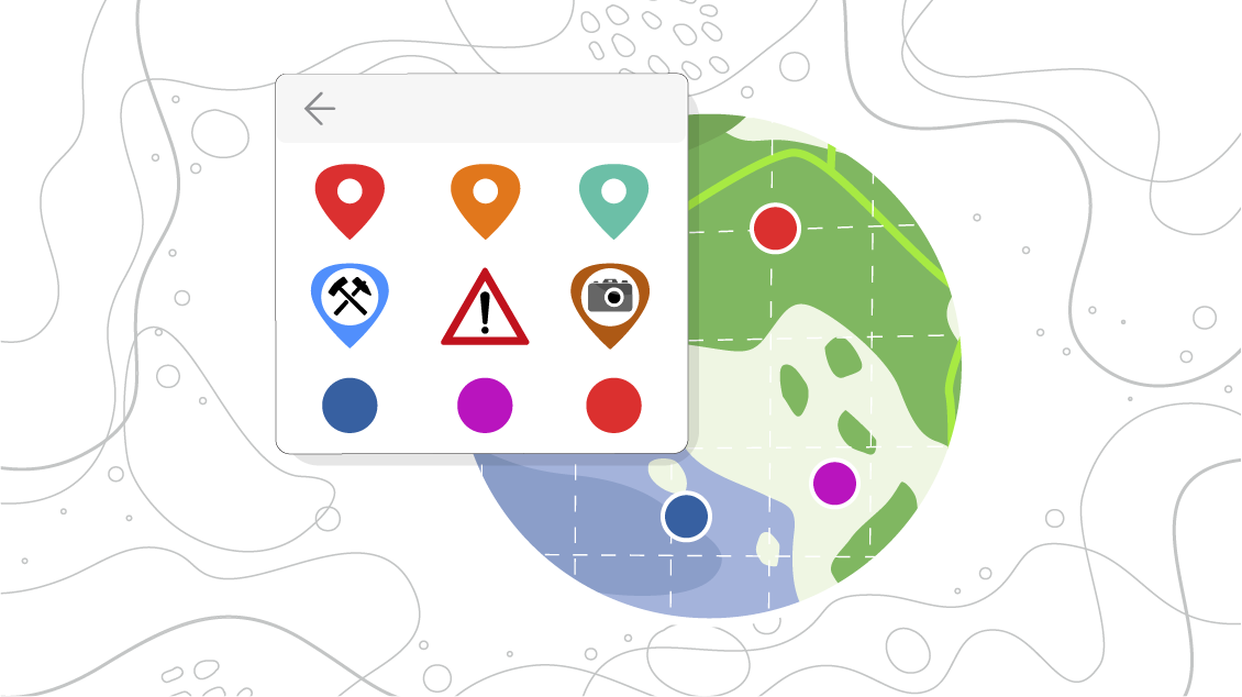
Extended symbology set
Our users’ opinion is important to us, so based on your requests we have extended the list of symbols used for creating points. Now you can select symbols for objects from the existing list or add and customize your own symbols.
Download eLiteMap app for mobile devices
eLiteMap Team